Poverty 1997 Update
Each year, the Census Bureau releases poverty estimates for the nation as a whole and for each of the states. County level estimates, however, are produced less frequently.
This data sheet compares the results from the 1990 Census with the most recent poverty estimates for counties in the United States.
County Data Sheets
To find your county, click on the file that contains your county name. All counties are listed alphabetically.
To print your county, scroll down to it and print the current page(s) only. To print the entire series, print all pages in each file.
PDF Files:
~ ~ Each Data Sheet is 1 Page Long ~ ~
EACH OF THE FILES CONTAINS 30 COUNTIES.
Adair County through Cumberland County
Daviess County through Kenton County
Knott County through Muhlenburg County
Nelson County through Woodford County
County Maps
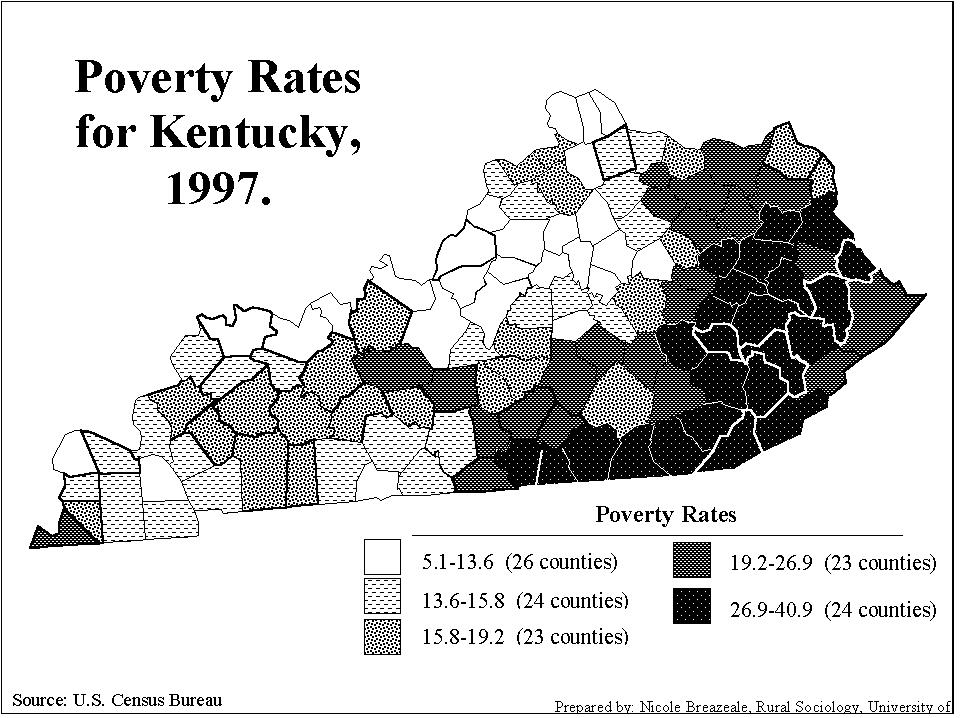
Poverty Rates for Kentucky (1997)
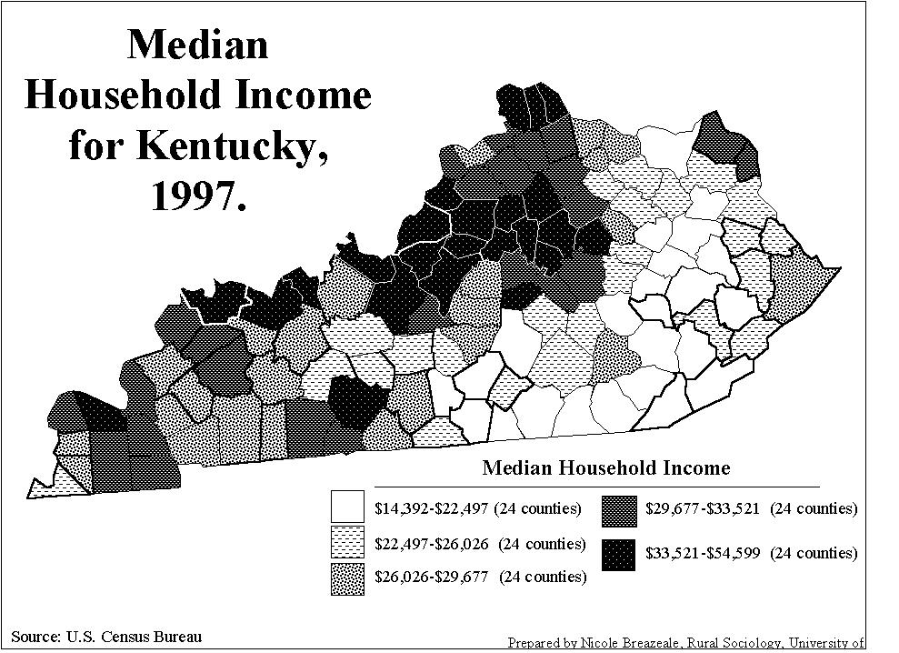
Median Household Income for Kentucky (1997)
Data Source
(updated)
These data are from the U.S. Census Bureau
http://www.census.gov/hhes/www/saipe.html
Additional information on county level poverty is available at the Kentucky State Data Center website http://ksdc.louisville.edu/
